Archive for the ‘New Zealand’ Category

East Coast and Penguins

Saturday, July 27th, 2013

After Te Anau and Milford Sound it was time to leave the West Coast and drive across the country to the more populated East Coast.

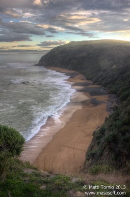
As we had a long day ahead of us we got up early in the morning. Soon enough we caught a pretty sunrise over some hills which definitely warranted a quick stop for some stops. Sadly there wasn’t much else to see during the inland crossing. Luckily New Zealand is not a wide country and soon enough we were on the other coast. While we didn’t really have time to properly explore this part of New Zealand we still wanted to do a short sidetrip to the Catlins. This sparsely populated region is excellent for wildlife encounters and some awesome scenery. After the rainy Milford the weather was a big improvement too, sunny and quite warm.

After reaching the town of Balclutha we turned off the main road and followed a rather small road down to the coast. Along the way we passed the small coastal village of Kaka Point and then reached our main destination, the Nugget Point. This is one of the iconic landmarks in this part of New Zealand. After a shortish walk we reached a small lighthouse at the of the steep headland. The headland is surrounded by numerous small islets, the actual “nuggets”. It’s also an excellent spot to observe the countless birds living in the area.

There’s also a penguin colony nearby but sadly at this time of the day all of them were out in the sea. The area is also popular hanging spot for seals and sea lions and we actually spotted a lone sea lion bull on the beach just after Kaka Point. Sadly he plunged back into the ocean before any of us was able to take a photo.

All in all this sidetrip was a big success even if Jacinta had to skip some of the longer walks as she wasn’t feeling too well.

After a quick picnic stop in Balclutha we started driving north along the coast towards Dunedin and eventually Oamaru, our stop for the night. Dunedin is the main city in this area and an important cultural center in New Zealand. The area also has numerous opportunities for observing the rich wildlife along the coast. Sadly we didn’t have time for a stop there, as we had to get to Oamaru before sunset to observe the penguins there.

We did have one stop along the way at the Moeraki Boulders. This part of the coast is a rather curious sight as erosion has formed large spherical boulders. Many of them look almost like eggs of some giant creature!

Our final stop of the day was Oamaru, one of the few places in New Zealand with both a blue penguin and a rare yellow-eyed penguin in close proximity. As all of us had already seen the blue penguins or little penguins as they are usually known in Australia, we focused on the other colony. Like little penguins the yellow-eyed penguins spend the day out on the sea hunting for food and return to their colony for the night. They do keep slightly more convenient hours though and generally return an hour or two before the sunset already.

The yellow-eyed penguins (or Hoiho as they are also known) are quite rare with an estimated population of only 4000. Along the coastline there are various hides where you can observe the colonies without disturbing the birds. In Oamaru the penguins can be observed from the cliffs above the colony. Sadly this meant we were quite a distance from the penguins so they are appear rather tiny even on my 300 mm lens.

Winter is usually the worst time to observe the birds as they tend to be lot more numerous over the summer months. We were still able to spot quite a few penguins wading in. Even if quite a few times it may have been the same birds as the penguins kept going out again while looking for their own nests!

After the penguins we spent some time in Oamaru itself. There’s a large blue penguin colony in the harbour area, but we decided not to take the tour. Instead we spent some time enjoying the pretty sunset nearby.

But Jacinta and I hadn’t had quite enough of the penguins yet, so we got up really early in the morning for another chance of spotting the Hoiho. Good thing we did too, we got treated to a magnificent sunrise and saw quite a few penguins leaving their nests too. And to make it even better there was also a seal family hanging out on the beach, too!

After this great experience it was time to start heading back towards Christchurch as our return flight was leaving really early on the following morning.

We did a couple of quick stops along the way and then got back to Christchurch itself where we visited a nice Sunday market. Jacinta and I also did some walking in the Botanic Gardens and then all three of us met up for another Light up the Leafy Night event in the gardens. This was a rather pleasant way to finish up the trip!

After a nice dinner and a few hours of sleep we drove down to the airport and caught an early flight back to Melbourne. Sadly my cold was getting quite nasty at this point, but it was too late to spoil an excellent trip!

Milford Sound

Friday, July 26th, 2013

Te Anau was our base for the part of the trip I was looking forward: the magnificent Milford Sound fjord. Despite its remote location Milford Sound is the one of the most popular tourist destinations in New Zealand and it’s also the only fjord in Fjordland that can be accessed by road.

The 121 km Milford Road from Te Anau to Milford Sound is an experience in itself. However, to make our schedule work better we decided to get going early in the morning, get to Milford Sound early and visit the sights on the way back. Parts of this road are also one of the most avalanche prone in the world and it is occasionally closed in winter for safety reasons. Luckily for us the conditions were quite good during our visit. Shortly before the Sound itself the road enters the Homer Tunnel. This 1270 m long tunnel pierces the mountains separating Milford Sound from rest of the Fjordland.

Soon after the tunnel we arrived to the small tourist village next to the Sound itself. From there we headed straight to the boat terminal and our boat cruise in the Sound. The massive boat terminal seemed rather quiet in the winter, during the peak season the place must be packed though. Best way to experience the fjord is obviously on water and most visitors take a boat tour while visiting. Milford Sound is also a popular destination for big cruise ships. There are also various water activities available including kayaking and diving. Sadly the dive operators are not very active during the winter season and in any case I was still suffering from the cold.

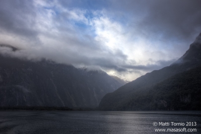
With 182 rainy days and almost 7 m of annual rainfall Milford Sound is one of the wettest place in the world. So it’s not very surprising that it was raining during our visit too. Luckily the rain wasn’t that heavy for most of the time. Still, with heavy fog everywhere it was hard to see the full magnificence of the fjord. Especially for photos it would be very nice to visit on a clear day when the mountains surrounding the fjord aren’t all covered in fog.

Still, the fjord was an impressive sight indeed. The almost sheer walls of the fjord are over 1 km high with several higher peaks in the area. There are only two permanent waterfalls but on a rainy day like this the walls are covered by countless smaller waterfalls. As a big fan of waterfalls I was very much impressed. At one point our boat actually took us right next to one of the waterfalls. A rather cool (and wet) experience!

The fjord is also home to a variety of marine mammals, including seals, whales and dolphins. We only saw some seals hanging out on some rocks though. We still got to experience more of the marine life as we had booked a visit to an underwater observatory as part of our cruise tickets. This floating observatory is anchored near one of the sides of the fjord and offers an impressive glimpse of the rich marine life in the area. Somewhat surprisingly we were the only people doing this part of the tour, our cruise boat simply dropped us off at the observatory and moved on.

The underwater environment of Milford Sound is quite unique. The combination of massive rainfall and the waterfalls forms a layer of fresh water on the surface of the fjord. With all the tannins in the water this layer is almost impenetrable and blocks out most of the sun light. This means that species that can normally only be found at much greater depths are found close to the surface.

The main example of this is black coral which is typically only found well beyond recreational diving depths. Here it starts appearing from depths as shallow as 10 meters. The name black coral is bit of a misnomer. The coral is actually white when it is still alive, it only becomes white when it dies.

The fish life around the observatory was also very rich for temperate waters. In addition we saw several smaller sharks passing by. We all enjoyed this part of the tour quite a bit. And as for myself I’m quite keen to go back to Milford Sound one day and do some actual diving in the area!

After a while the next cruise boat was passing by the observatory and it was time for us to move on. We hopped on to the new boat to finish our tour of the fjord. We passed near a few more impressive waterfalls but all too soon we were back at the boat terminal.

It was still raining a little bit when we got back to the shore so instead of doing any of the short walks in the area we decided to hop in the car and start the drive back.

Our first stop was the Chasm only a short drive away from Miford Sound itself. The Chasm is a series of small waterfalls and holes carved in the rock by the river. Pretty impressive sight, especially on a rainy day. At the Chasm car park we also had a close encounter with the native alpine parrots, Keas. These very curious and intelligent birds are very friendly and seemingly not afraid of humans at all. They also love to steal food and other things. In our case this included our car’s radio antenna and Jacinta’s jacket! Luckily both of them proved much for the birds.

Our next stop was Lake Marion Falls shortly after passing through the Homer Tunnel. The Falls can be reached by a short walk from a side road and are located in a beautiful patch of temperate rainforest. The walk there was quite nice and the falls themselves are pretty enough.

We had few other stops along the way too, including the Mirror Lakes. On a calm day these small lakes display a perfect reflection of the surrounding mountains. Sadly the rain was picking up again so the reflection we got was quite blurry.

After an excellent (if little bit wet) day exploring Milford Sound and the Milford Road we finished off the day in Te Anau.

Wanaka and Queenstown

Wednesday, July 24th, 2013

After Haast Pass we entered a totally different landscape. The West Coast on the other side of the mountains receives massive rainfall but

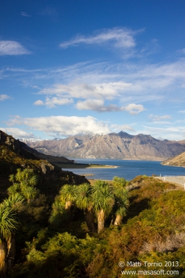
The weather changed completely too. The constant drizzle was replaced by sunny skies, a perfect weather to enjoy the awesome scenery. The road is nestled between two large beautiful lakes, Lake Wanaka and Lake Hawea. And the mountains in the distance make the scenery even prettier.

After quite a few photography stops along the way we finally arrived in Wanaka itself. We still had some driving left to do until our overnight stop in Queenstown, but we still decided to stop there for a while for some shots of the sun setting over the lake. Unfortunately we weren’t really getting much color in the sky so it was time move on again.

We had hoped to take straight road to Queenstown over some small mountains and get enjoy the last moments of sunlight from higher up. Unfortunately shortly after leaving Wanaka we found the road blocked. There had been an accident further ahead. We had to turn back and take the longer way around. Not very scenic but is was starting to get quite dark anyway.

Eventually we arrived in the Queenstown itself. Queenstown was a big contrast to all the other towns we had passed along the way from Christchurch. Based on population alone Queenstown is a fairly small town but this is more than made up by the fact that it is also the center of adventure tourism in New Zealand. The place is full of hotels, restaurants and entertainment venues. The location is pretty perfect too, as the town is situated between mountains on one side and the picturesque Lake Wakatipu on the other side.

We haven’t planned to do any major adventure activities during the trip, so there was little for us to do in Queenstown itself. After a good night’s rest we spent some time strolling along the Lake Wakatipu shoreline and finished the walk at Queenstown Gardens. These pretty gardens surrounded by the lake are pretty enough on their own and they also have great views of both the lake and Queenstown itself. With only a few flowers in bloom in winter it wasn’t really the best time to visit, but it was still a pleasant experience.

After some quick souvenir shopping it was time move on. We followed the Lake Wakatipu shoreline towards the small settlement of Glenorchy. This area is the starting point of the famous Routeburn Track walk but apart from that and the other hikes there’s little to do in the area. The windy road itself is one of the prettiest drives in New Zealand though and well-worth the time spent. There are several nice short walks in the area and the views over the lake and the mountains beyond are quite majestic.

After lots of photos and a quick stop in Glenorchy itself it was time to head back to Queenstown and then onwards toward our stop for the next night, Te Anau. After Queenstown the first section of the road follows Lake Wakatipu shoreline and offers more superb views of the lake and the mountains.

Eventually we passed the small settlement of Kingston at the southern end of Lake Wakatipu. Unfortunately after Kingston the scenery gets rather boring as the road enters a large area of rolling hills with paddocks and farms. There’s little worth stopping for until Te Anau itself and the awesome sights of Fjordland.

West Coast and the Glaciers

Tuesday, July 23rd, 2013

We stopped for the night at Springfield, the last town before the Southern Alps. The Alps split the South Island in two and can only be crossed through a few passes. From Springfield the windy road continues to Arthur’s Pass before starting the plunge down towards the isolated West Coast.

Unfortunately our luck with the weather had ran out at this point. The day was really cloudy and it was raining almost constantly. And to make matters even worse it was really foggy too making any landscape photos more or less impossible. We still had a couple of quick stops along the way but with the weather so miserable we didn’t bother much with sightseeing. There are some rather impressive waterfalls right next to the road after Arthur’s Pass. But they are lot less impressive when you can barely see them through the thick fog.

Things didn’t really improve on the West Coast either. To be fair that wasn’nt really surprising, as West Coast is well-known for the its massive rainfall. We did have a rather lengthy stop in Hokitika though. Hokitika is the center of the jade industry in New Zealand and contains numerous jade studios and various art galleries. While not really my cup of tea it was still a decent way to spend a rainy afternoon.

As weather didn’t really improve much after Hokitika we just kept driving towards our destination for the night, the Franz Josef Glacier. Luckily rain had finally stopped by then and as we had some daylight left we decided to do the short walk to the glacier edge. Only guided tours are allowed on the glacier itself, but you can still get reasonably close to the glacier after a reasonably walk. Franz Josef Glacier and the nearby Fox Glacier are one of the few glaciers right next to a (temperate) rainforest.

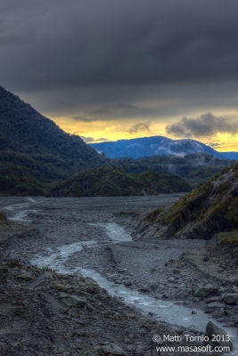
It was pleasant enough walk through the glacial valley and the glacier itself is an interesting enough sight. The glacially-formed valley floor is also quite interesting and along the edges there are several smaller waterfalls. And to make things even better we also got treated to a rather nice sunset on the way back.

After the hike to the glacier edge it was time to catch some dinner and then we headed to our hostel for the night. As a nice bonus our hostel had a sauna. Obviously just an electric one at a rather low temperature, but it’s still better than nothing; especially after a damp day.

Luckily weather had improved a little bit by the next morning. We decided to skip the walk to Fox Glacier and instead visit the nearby Lake Matheson. This lake is well-known for its picture-perfect reflections of the nearby mountains and a very popular subject of postcard photos. On a cloudy day like this it was not quite as impressive sight but still very pretty. Eija and I also had a quick swim in the lake after we finally found a way to get to the actual water edge. By then it had started raining again and the water was rather cool to begin with, so this was another refreshing experience.

By the time we got back to the car things were getting quite damp for everyone. In any case it was time to move on and leave the glacier towns behind us. Luckily the rain didn’t last so we did have a few other quick stops along the coast, including the wild Monro Beach and the pretty Knight Point.

Then it was time to head to Haast, our last stop before crossing the Southern Alps again. But before Haast we had to cross Haast River and the longest one-lane bridge in New Zealand. South Island is full of one-lane bridges but at 737 meters the Haast Bridge is in the league of its own.

Haast itself has little to do or see, but along the way through the Haast Pass there are several nice stops. We did several short bushwalks and visited a couple of nice waterfalls. Of particular interest were the Blue Pools, a series of deep pools with crystal clear water. The azure blue water comes from glaciers and you can easily see all the way to the bottom.

Akaroa and Banks Peninsula

Sunday, July 21st, 2013

After the Gondola and Lyttelton we drove on down the coast to the hilly Banks Peninsula. This old volcanic caldera is a big contrast to the city itself. With picture-perfect hills and countless secluded bays this area is a very popular holiday destination. On a sunny day like this the area also provides lots of great photo opportunities. The most spectacular views were down from the windy tourist road leading to Akaroa, the main settlement in the area. High up from the hills Akaroa Harbour is a magnificent sight.

Unlike most of the South Island Akaroa was originally settled by the French. While this makes very little practical difference these day this fact is milked to a great extent while marketing the town. All the streets have French names and many of the restaurants have a French theme too. As the only real town on the Peninsula the place can get awfully busy in the summer. But luckily in the winter it’s nice and quite, yet still beautiful. Sadly this also means that quite a few places close down for winter.

After a quick stroll through the town I got back to the harbour to get some sunset shots with the sun going down behind the big hills on the other side of the bay. Unfortunately the sunset itself was rather disappointing with very dull colors. But luckily the golden colors on the hills behind Akaroa were beautiful indeed. I also did some night photography in the harbour area with some decent results.

We had few hours of time to spare so on the way back we walked up the Onawa-Pa, an old hillside Maori fortification. There’s little left of the settlement itself but it’s easy to see why ancient Maori picked the spot. This steep hill within the Akaroa Harbour is only connected to the mainland by a narrow landbridge making the position extremely defensible. And the views are spectacular too! The walk up the hill is bit of a hike, but even Eija made it after some huffing and puffing.

After our walk it was time to head back to Christchurch to pick up Jacinta who was flying in few days after me and Eija. We picked her up from the aiport and then started driving inland and finally towards the mountains!

Christchuch – The Quake City

Friday, July 19th, 2013

After spending the first two weeks of Eija’s visit around Melbourne we moved on to New Zealand. We departed Melbourne on the 18th July and landed on the South Island around midnight.

Our journey started in Christchurch, the main air travel hub on the South Island. Christchurch was hit by a series of massive earthquakes in 2010 and 2011 and the damage was still visible almost everywhere.  Despite the valiant rebuilding efforts damaged buildings and streets were a very common sight. The historic buildings around the city center were hit particularly hard. Perhaps the worst example is the famous Christchurch Cathedral which suffered serious structural damage and will have to be demolished.

During our first day in Christchurch we did quite a bit of exploring in the city itself. Sadly many of the shops and other buildings are still closed down after the earthquakes and for a city of this size there was precious little stuff to do. “Quake tourism” does have some novelty value but gets old quite quickly. We even had trouble finding a place to buy breakfast, so quite quickly we decided to head out of the city center itself.

Luckily the Botanic Gardens and the Canterbury Museum suffered only minor damage and were up and running. After getting some quick breakfast in the cafe we checked out the museum. Main highlight for me was definitely the section on polar exploration. Back in the day New Zealand used to be one of the main bases for Antarctic exploration. The Gardens were pretty nice too, even if Winter is not really the best time to visit. During the colder winter months only a few flowers were blooming and the colors were rather subdued.

Afterwards we spent some more time in the city, including a visit to the city center and the cathedral. The cathedral itself is very badly damaged and is currently fenced off so a closer look was not possible. We also visited the Re:Start Mall, a temporary mall built in shipping containers. Apart from that there really wasn’t much else to do in the city center so it was time to head back to our hostel for some rest and sleep.

On our second day we picked up a rental car and had more chances to explore the outskirts of the city. We started in Willowbank Wildlife Reserve, a nice wildlife zoo within the city. The reserve is heavily focused on native NZ animals, but there are also other critters there too. Here we also saw our only live kiwis of the trip. Sadly the birds are nocturnal and during daylight hours they are kept indoors in almost complete darkness. This doesn’t work too well for photography since flash is obviously not allowed.

After visiting the reserve we headed down to the coast.  We briefly visited the New Brighton Pier and then headed to Sumner, a seaside suburb in Christchurch. The main attraction here is the Cave Rock, a large rock full of caves right next to the ocean. Sadly large parts of the rock collapsed in the earthquakes and the caves themselves are now off limits.

We got back to our hostel and then I headed down to the city by myself. The Botanic Gardens was running a special night event called Light Up the Leafy Nights. While majority of the program was aimed at kids the various light shows made for some nice photos. Particularly impressive was the “burning flower” accompanied by a live band.

On the third day it was time to head out of Christchurch itself. But first we stopped at the Christchurch Gondola that took us high up to the hills bordering the city. After a few cloudy days weather had finally turned sunny and we had an excellent view over the city, including our first proper look of the mountains further inland.

Before the Gondola we also had a quick stop at the nearby suburb of Lyttelton. This is the location of the main port of Christchurch, well illustrated by the massive piles of timber waiting to be shipped out. Sadly the area suffered heavy damage in the earthquakes and there wasn’t much to do there.

Near Lyttelton we also dipped in for our first swim of the trip. The ocean was definitely refreshing (read cold) but at least the day was sunny and warm so we warmed up quickly. And apart from few passers-bys we had the whole beach to ourselves. 🙂

Trip Reports for November

Thursday, January 3rd, 2013

The photos and trip reports for my two major trips in November are finally up! They were Wilsons Prom with MUUC and New Zealand by myself.

With those out of the way there’s still some catching up to do. There has been some excellent diving around Melbourne in late November and December and I have several excellent photos to post. Additionally, some of my family and friends are currently visiting Australia and I have done several nice day trips with them, including another Great Ocean Road trip.

And finally, there are still some files missing from the new site. I’ll get the dead links and missing images fixed as soon as I can.

Rainbow Warrior

Tuesday, November 20th, 2012
Access denied for user 'masasoft_mtornio'@'localhost' (using password: YES)Error loading character set utf8: Access denied for user 'masasoft_mtornio'@'localhost' (using password: YES)Error loading character set utf8:

After Poor Knights it was time to dive perhaps the most famous wreck in New Zealand, the Rainbow Warrior. This Greenpeace flagship was sunk in 1985 by the French intelligence service in an act of terrorism. The French agents placed two bombs on the vessel while it was docked near Auckland and it sank with one casualty. The wreck was refloated during official investigation and later scuttled in Matauri Bay near the Cavalli Islands.

Nowadays it forms an artificial reef and it is a popular diving site, both for the rich marine life and the historical value. The wreck lies in 26 meters of water and it is easy to penetrate. There’s lots of colorful growth on the outside of the wreck and plenty of fish life inside. While diving around Poor Knights Islands was certainly excellent, this was the dive I was most looking forward to during the trip.

Unfortunately weather took another turn for worse. Forecast for Tuesday was pretty reasonable but in practice the swell was quite high and it was raining heavily pretty much the whole day. We were out on a fairly small boat and it was definitely the poorest weather I have been out with on a commercial diving boat. So the conditions were pretty unpleasant, at least I was diving in drysuit. Not that it ended up preventing me from getting wet in the end.

Things started smoothly enough, we went down to the wreck and conditions below surface were lot better than on the surface. Unfortunately, after some time on the wreck I noticed my dump valve was acting up again. I was buddied with just the guide so we started heading up along the rope, I let some air out of the neck seal and got pretty wet in the process. However, on the way up we managed to figure out how to fix the issue so we decided to continue the dive for a while longer. By the time we got back to the boat I was really cold and wet but on the other hand I got to do a long nice dive on the wreck!

Conditions were not really suitable for drying up anything, but I warmed up the best I could on the boat and we improvised some new (and less wet!) undergarments. Then we went down for our second dive at the nearby True Love Reef. This time around I was down with just a British couple who were also in drysuits, the rest of the divers had had enough of the poor weather and cool water and decided to stay on the boat.

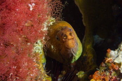
This was an excellent reef site with nice walls and very rich fish life. There were lots of nudibranchs along the wall and some morays as well. Again things were pretty ok underwater. Back on the surface it did look little scary though when large waves were breaking on some rocks near where we surfaced.

As you can imagine my New Zealand diving didn’t quite go as planned. I still had some excellent dives and I’m really keen to do more diving there later on!

Poor Knights Islands

Sunday, November 18th, 2012
Access denied for user 'masasoft_mtornio'@'localhost' (using password: YES)Error loading character set utf8: Access denied for user 'masasoft_mtornio'@'localhost' (using password: YES)Error loading character set utf8: Access denied for user 'masasoft_mtornio'@'localhost' (using password: YES)Error loading character set utf8: Access denied for user 'masasoft_mtornio'@'localhost' (using password: YES)Error loading character set utf8:

On Sunday I finally got to diving. Weather was still pretty rough and the boat ride to the islands was somewhat bouncy. Luckily we were able to find some really sheltered sites there.

There were large schools of fish visible from the surface and I was really looking forward to the dive. We were diving a small sheltered bay, starting from one side and then crossing over to the other. Unfortunately visibility was rather poor when we got down below the surface and there was some surge from the swell as well. The dive itself was nice enough, but a poor match for the fisheye lens I had on.

The second dive was at another sheltered site where we followed a beautiful wall for most of the dive. This time around I used my macro lens with some better results. Still, both my dives were pretty short due to my buddy. He was a real old-timer who had been diving for literally decades. And he obviously had lots of cool stories to tell. But this was also his first dive in five years so he went through his air really quickly. Not really his fault, but somewhat annoying nonetheless.

Luckily on the Monday things improved considerably. Weather was lot better, we had clear skies and almost flat seas. On the way out from Tutukaka we met a pod dolphins, the people from the other smaller boat were allowed to swim with them. We had to content ourselves with watching and photographing the dolphins and the swimmers. The dolphins kept playing there for quite a while before finally moving on.

I was buddied with two other fairly experienced divers and we did our own thing for both dives. The first dive was at a site Northern Arch and likely the best dive of the trip. The site is well known as one of the best of the 60+ named sites around Poor Knights Islands. We started out following a large wall towards the arch itself. The arch looks pretty small on the surface but below surface its massive! The wall was really colorful and there was great variety of nudibranchs and fish all along the way. There were even some tropical fish there brought by the East Australian Current (or East Auckland Current as the locals want to call it).

And if that wasn’t enough near the beginning of the dive we visited a really cool small cave that was just large enough for the three of us to fit in safely together. The water near the end of the cave is actually brackish and there are some freshwater species living there! Just a shame visibility wasn’t really good enough for good wide-angle shots, while there was plenty of macro life around it felt such a waste to use macro lens on a site like this.

The second dive of the day was Trevis Rocks. This series of three small pinnacles is another great good site with good fish life and lots of nudibranchs. We found only two of the three “rocks” before heading closer to the shore. There we visited another small cave and then spent rest of the dive in the shallow water next to the island before returning to the boat.

And then on the way back to Tutukaka we spotted another pod of dolphins! What a perfect way to finish up an excellent day of diving.

Whangarei and Northland

Friday, November 16th, 2012

Unfortunately I got some more bad news when I got to my accommodation next to Whangarei Falls. Due to heavy winds diving had been cancelled for the next day. So it was again time to come up with some alternative plans.

While it’s certainly easier to get around with a car, it’s still possible (if not convenient) to visit many of the attractions near Whangarei by foot. After spending that first day in the city I hiked up Mount Parihaka for some nice views, too bad it had already gotten quite dark when I got there.

On Saturday I was supposed to be out diving but obviously that didn’t work out. So I ventured out bit further from the city. The Quarry Gardens, a subtropical garden planted by volunteers, was a surprisingly nice area. There was great variety of plants (particularly various cacti) and even a pair of small waterfalls. The small gardens in the city itself were nowhere as nice!

With plenty of time in my hands I also decided to visit the nearby Abbey Caves. It’s bit of a hike to get there on foot and unfortunately it also started raining heavily while I was on my way. By the time I got there I was soaking wet. And to make matters worse the caves were slowly filling up with water and the rocks were getting quite slippery. Still, after walking all the way there I decided to take a peek inside the caves. The first one looked somewhat unsafe in those conditions, but luckily I was able to enter the other two and take some shots. It would have been nice to explore the caves properly, but I didn’t feel like pushing my luck with the heavy rain.

On the way back I followed the walking track along Hatea River. There are some nice walks along the way and several massive Kauri trees, too. After a long day out I finally got back to Whangarei Falls and my accommodation. All in all a pretty nice day despite being cold and wet by the end of it.

Luckily weather improved for Sunday so I was able to head out for some diving around Poor Knights Islands (see next post for details). I was also able to spend the Monday there (in some great weather for a change) before heading further north to Kerikeri to dive the Rainbow Warrior on Tuesday.

Due to my altered schedule I really didn’t have time for any sightseeing in Kerikeri. So I did the planned dives and headed back to Auckland for my return flight. The flight was a really early one, so after just a few hours of sleep I was on my way back to Melbourne. Despite weather playing havoc with my plans it was a really nice trip and I’m keen to visit New Zealand again. Two weeks was barely enough time to cover one half of North Island, so there’s still plenty left to do!